About Map Pad+ GPS Area and Length
MapPad is providing a simple mapping solution based on Open Street Map allowing location capture and data management. Please visit our website to find out how to get OFFLINE MAPS -...
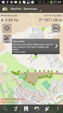
MapPad is providing a simple mapping solution based on Open Street Map allowing location capture and data management. Please visit our website to find out how to get OFFLINE MAPS - http://mappadapp.com/offline-maps-advanced-methodThis application can be particularly useful for anyone involved in forestry, agriculture, roofing, fencing, construction, planning or farming business. It also can be used in the whole range of outdoor activities like golf, biking, walking, running, jogging and other sports where possibility of measure area or length can be useful for development and further analysis in e.g. Google Earth.With MapPad, you can SHARE your tracks and measurements with Google Drive, G Mail, Ever Note or just display your track in Google Earth with only few taps of your screen.What works:- Calculate area (using Lambert azimuthal equal - area projection) [m2] - very accurate, please compare with other applications (I was testing it on the football pitch 90x60m getting area very close to 5400m2 - some applications the same area represent as 5000-5300m2 due to wrong map projection used when calculating areas from Lat, Lon coordinates)- Calculate perimeter of the area drawn- Measure length (using Vincenty formula for distance) [m] and show the bearing from A to B- 3 methods of measurement are now supported (Tap on the map, GPS location, Map cursor location)- Ability to SaveLoadDelete the measurements results- Export Measurement results to KML, GPX, CSV (To export go to Tools>Manage>Measurement, select element on the list then press Export)- Export Waypoints by Categories to KML, GPX, GPX as Track for Open Street Map, CSV To export go to Tools>Manage>Categories, select element on the list then press Export)- Direct Export and sharing of the data to Google Fusion Tables- Waypoints management - each waypoint is displaying the distance and direction to it from current location- Upload Measurements results directly to OpenStreetMap with few clicks.- Support for most common units length:[m, yd, ft, km, mi], area: [m2, ha, a, acre, km2, mi2]- Elevation profile available for measurements done by GPS- Import of KML and GPX files to the application- OSM Mapnik and Cycle map (Internet access required)- GPS status and satellites status- Address, location search (Internet access required)- Add points using current GPS position- Add points manually by selecting location on the map- Support for 3 different coordinate systems (WGS84, Web Mercator, British National Grid)- Possibility to edit points labels and description- Possibility of removing added points- Add/Edit/Delete categories- Ability to set default measurement units- Support for Bing Maps as a base map option (add your own enterprise or free basic Bing Map key in the settings for better performance)- GPS Tracking for measurementsPlease note:- If you experience any problems or have new ideas or comments please do not hesitate to contact me directlyKeywords: area, length, map, GPS, calculate, precision, measurement, waypoints, points, management, calculation, sport, travel, hill, walking, osm, forestry, agriculture, open, street, perimeter, bearing, maps, ruler, golf, area calculator, range finder, measure, area measure, distance measure, surface measurement, real estate, GPS measure, solar, landscape, area calculation, planimeter, fencing, perimerer, geo, property, roof area, solar panels, roofing, Export to GPX, Export to KML, Export to CSV, Upload to OSM, Upload to OpenStreetMap, Upload GPX, save, save measurements, waypoints management, Fusion Tables, offline
Previous Versions
Here you can find the changelog of Map Pad+ GPS Area and Length since it was posted on our website on 2014-06-13 11:20:39.
The latest version is 1.9.6 and it was updated on 2024-04-23 11:16:28. See below the changes in each version.
Map Pad+ GPS Area and Length version 1.9.6
Updated At: 2013-06-28
Map Pad+ GPS Area and Length version 1.9.6
Updated At: 2013-06-28
Changes: Several fixes and updates
Disclaimer
Official Google Play Link
We do not host Map Pad+ GPS Area and Length on our servers. We did not scan it for viruses, adware, spyware or other type of malware. This app is hosted by Google and passed their terms and conditions to be listed there. We recommend caution when installing it.
The Google Play link for Map Pad+ GPS Area and Length is provided to you by apps112.com without any warranties, representations or guarantees of any kind, so access it at your own risk.
If you have questions regarding this particular app contact the publisher directly. For questions about the functionalities of apps112.com contact us.